


Area Information
Find maps of the valley, Teton Village, National Parks and more.
If you're looking for a Jackson Hole map, we have put a few maps of the Jackson Hole area online for you. There is a map of the whole valley, the town of Jackson, Teton Village, Targhee Base, and our nearby national parks. Just load the image you want and you can print it to bring along with you on your Wyoming vacation.

This map is of the Jackson Hole Valley and shows where things are in relation to each other across the entire valley.
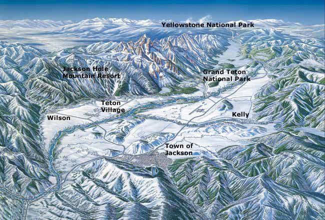
This map is of the Jackson Hole Valley and shows where things are in relation to each other across the valley.

This map provides street information for the central area of town.
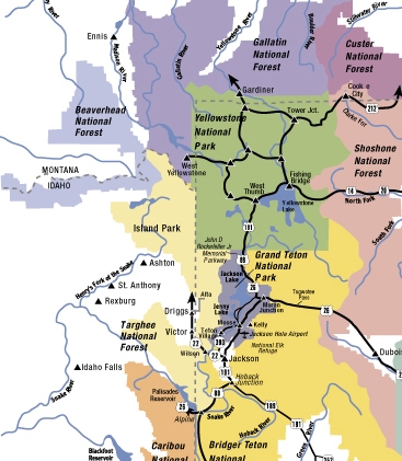
This map provides the layouts of the roads going to, from and through the Town of Jackson, Grand Teton National Park and Yellowstone National Park.

This map provides detailed driving directions to points of interest in Yellowstone and Grand Teton National Parks.

This map shows a detailed view of roads, hiking trails and bodies of water in Grand Teton National Park.

This map provides distances between cities and towns and Yellowstone's entrances.
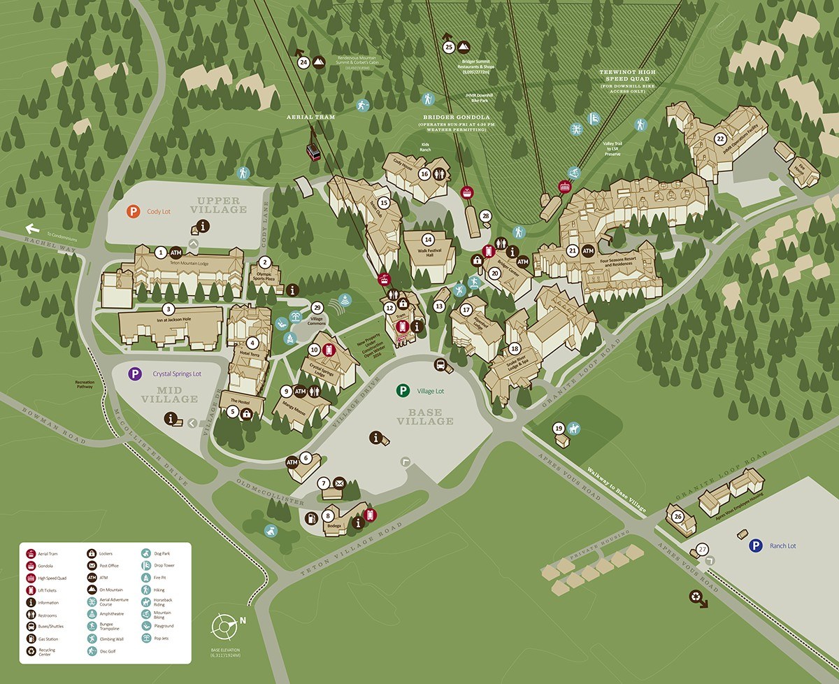
This is a detailed map of the base area of Teton Village.

This is shows a top-down overview of Teton Village.


